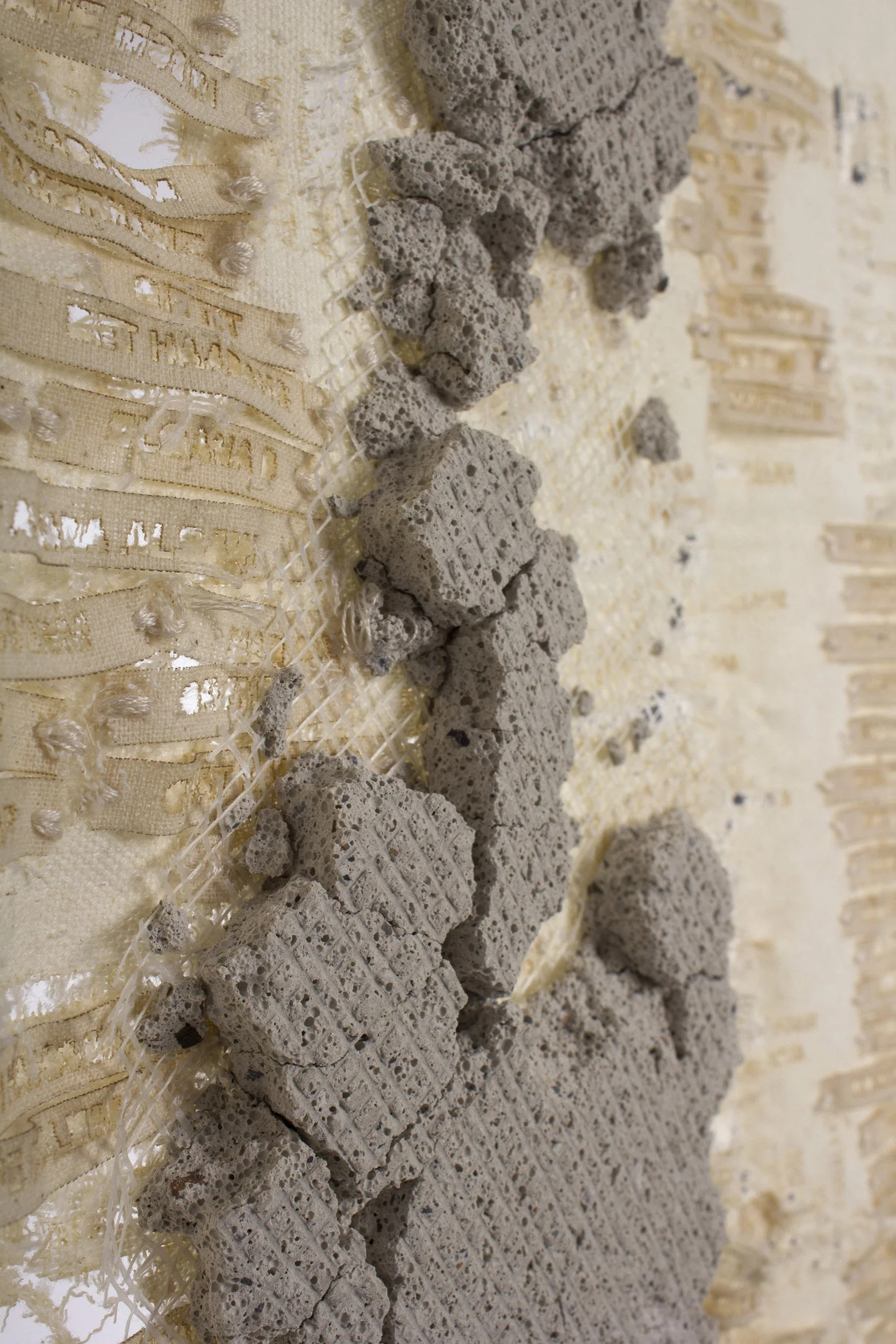
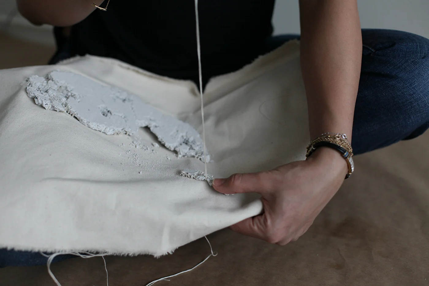
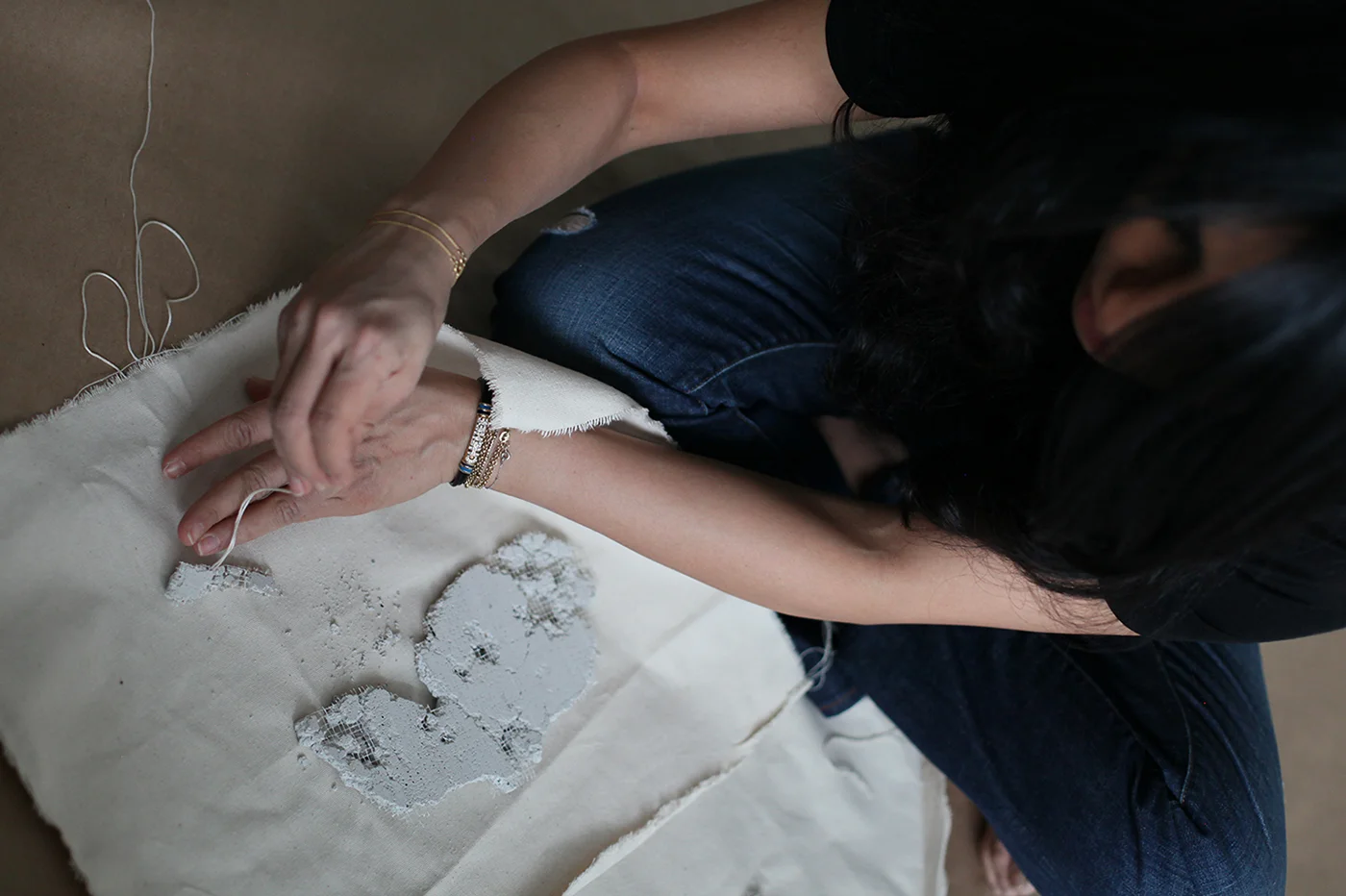
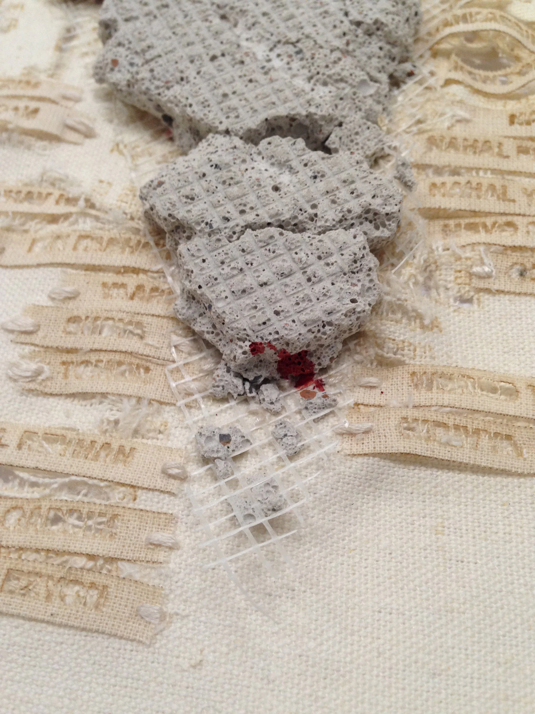
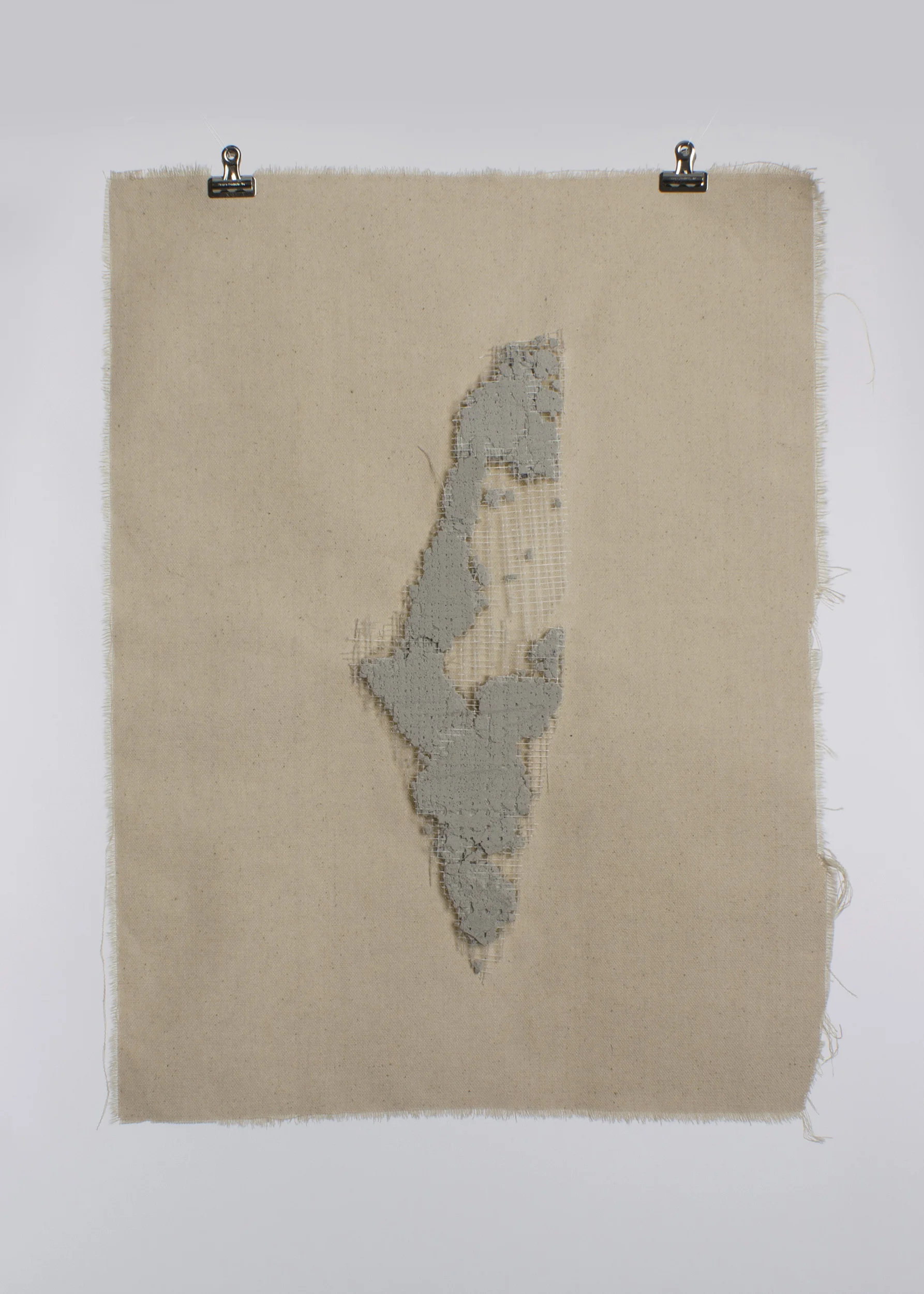
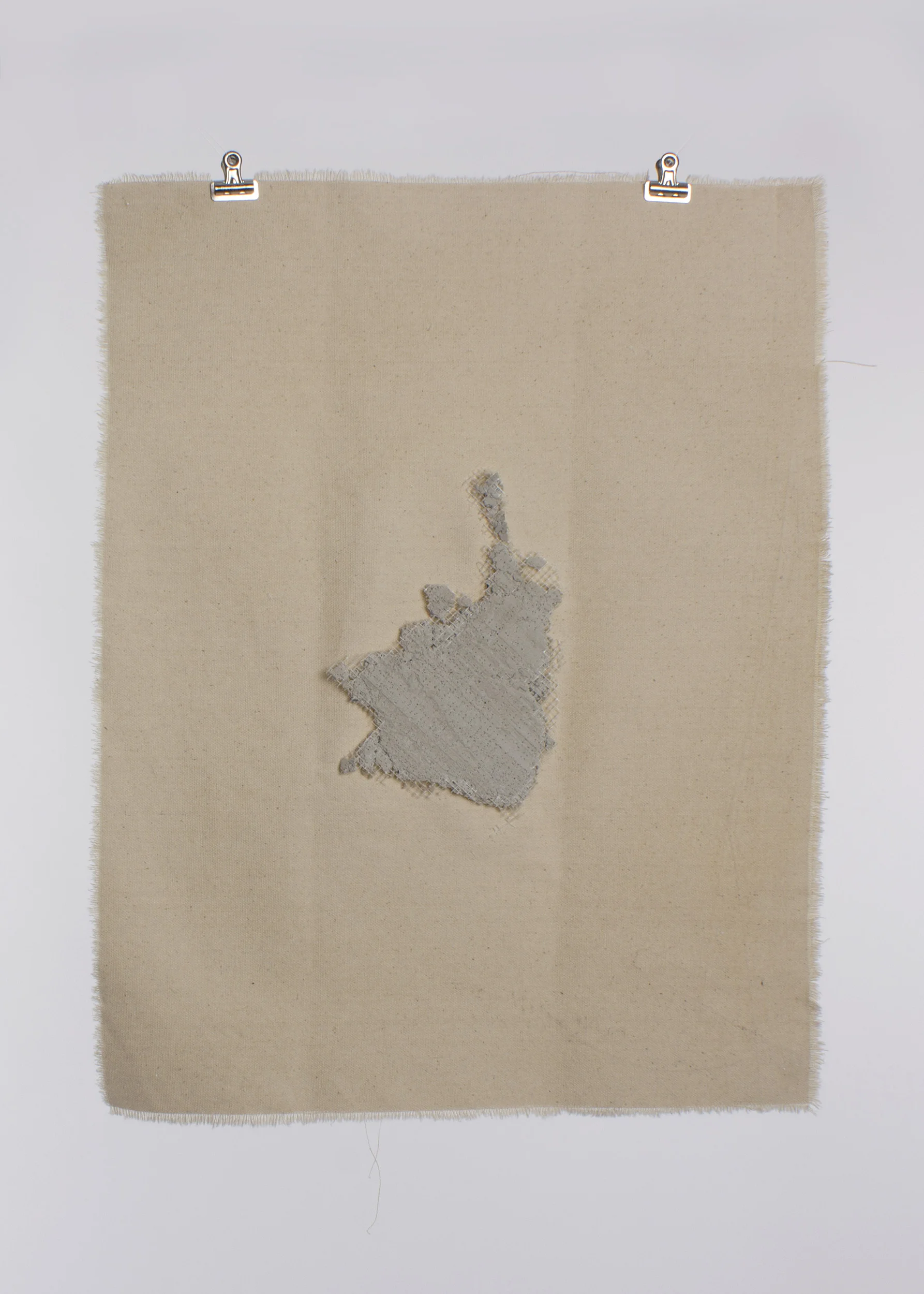
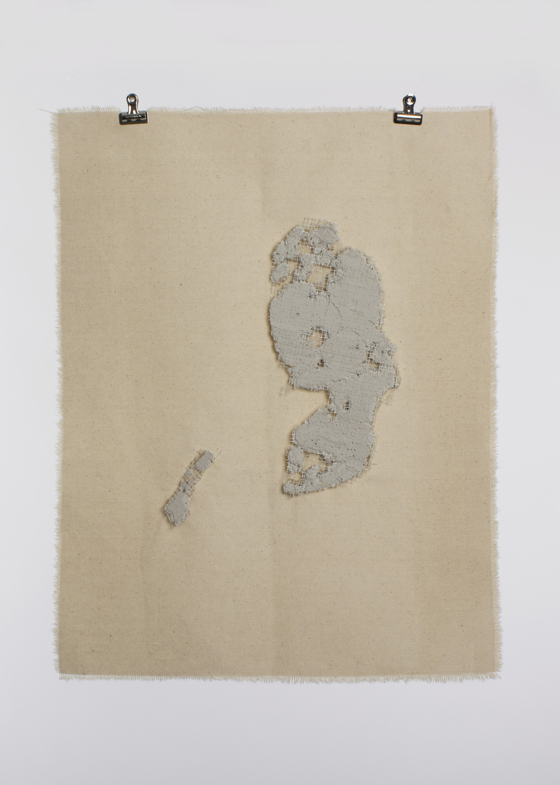
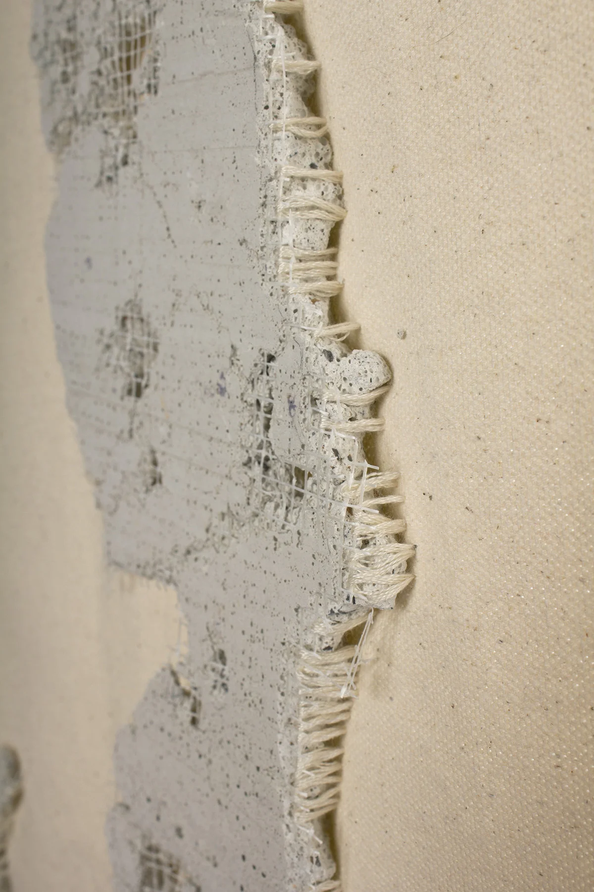
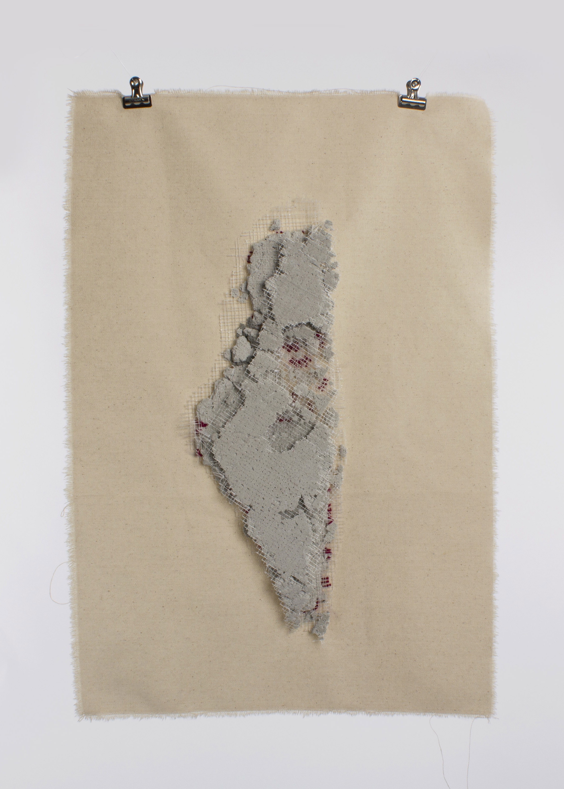
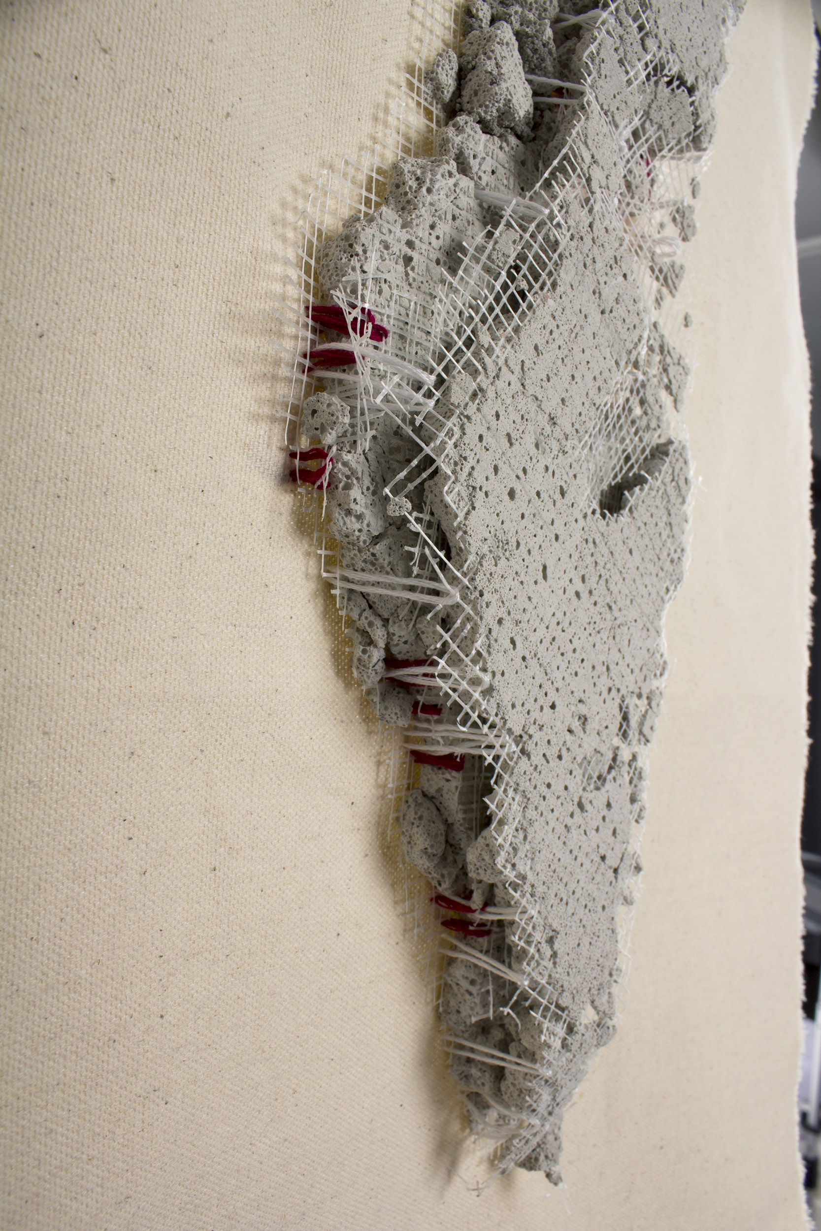
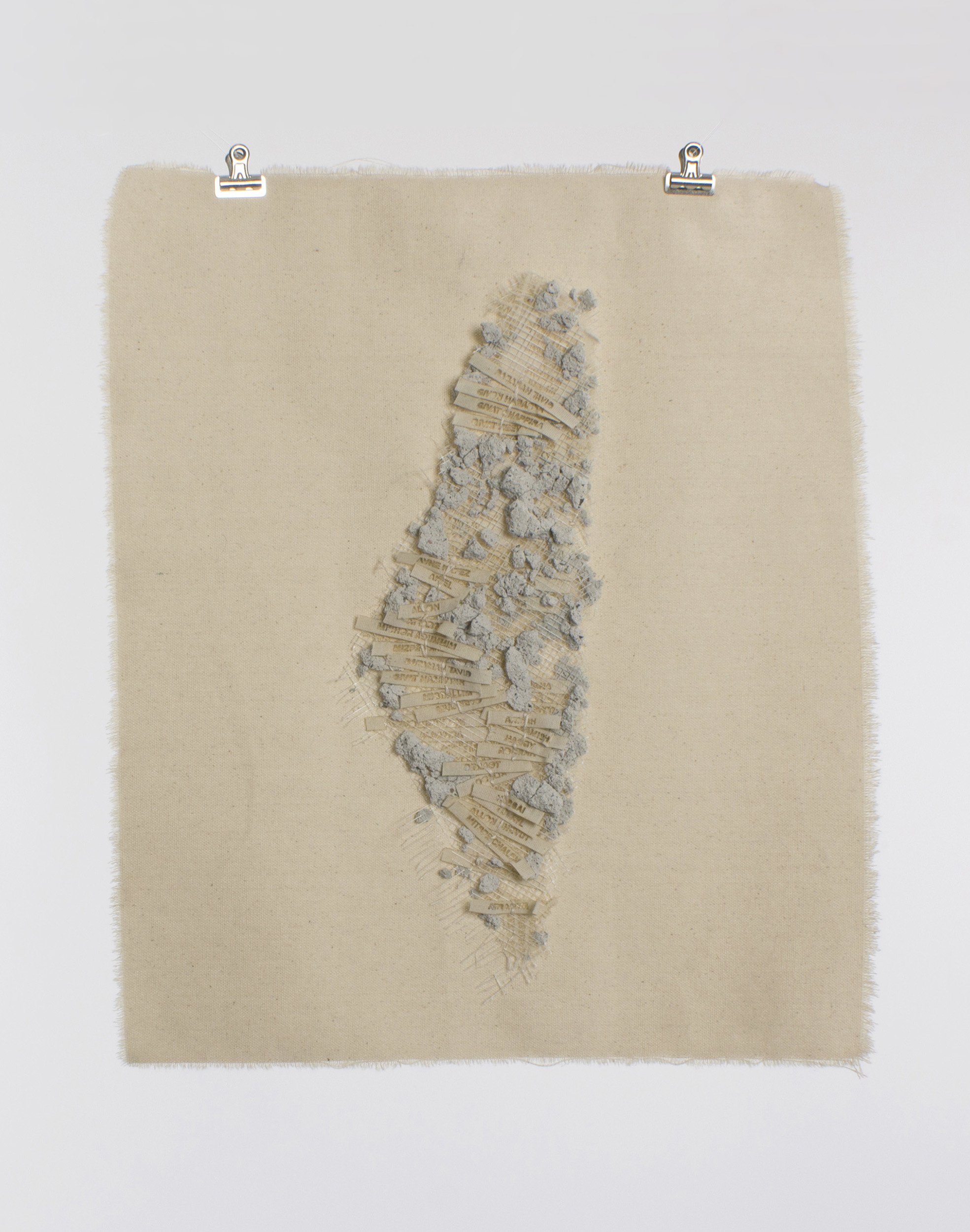
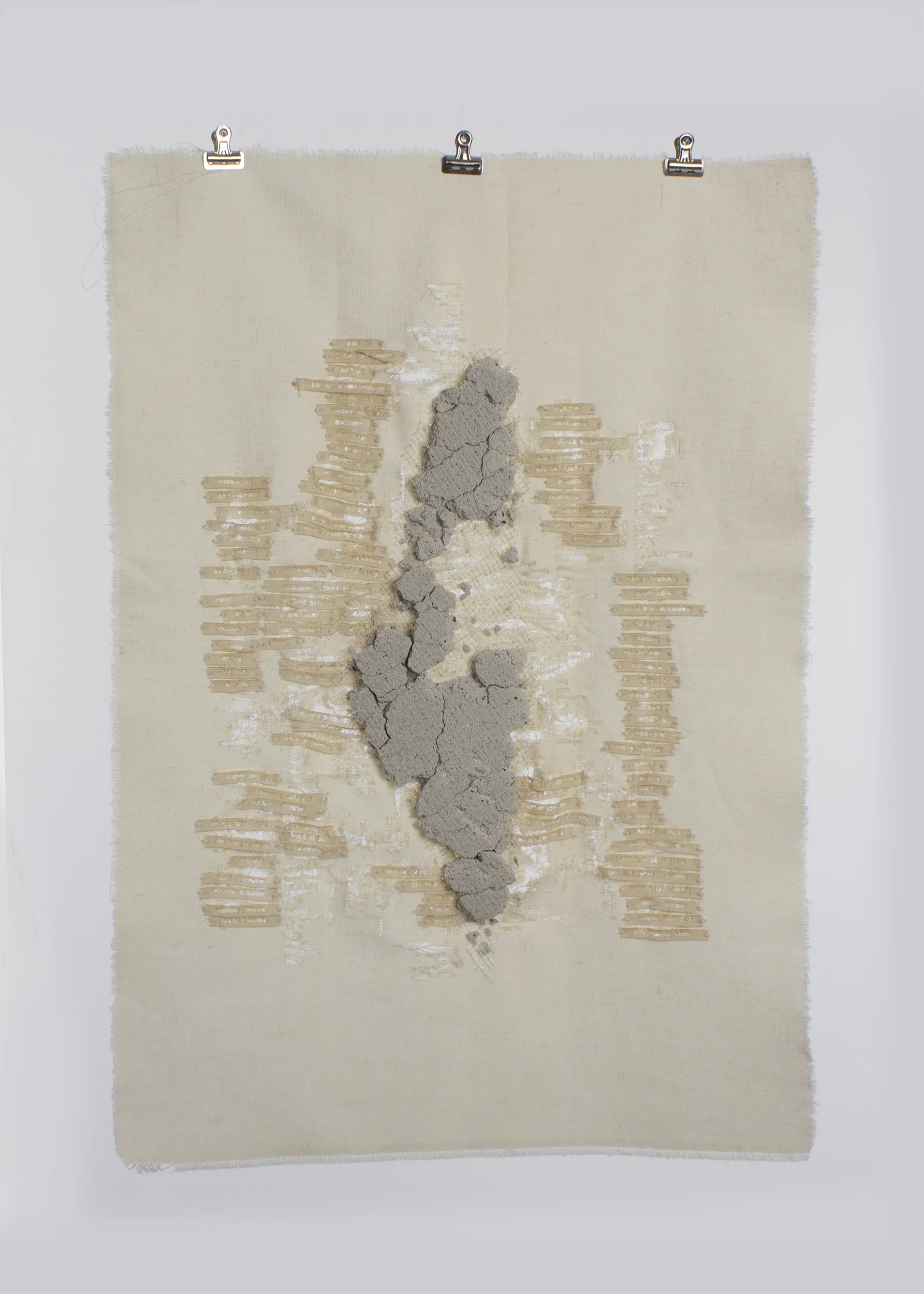
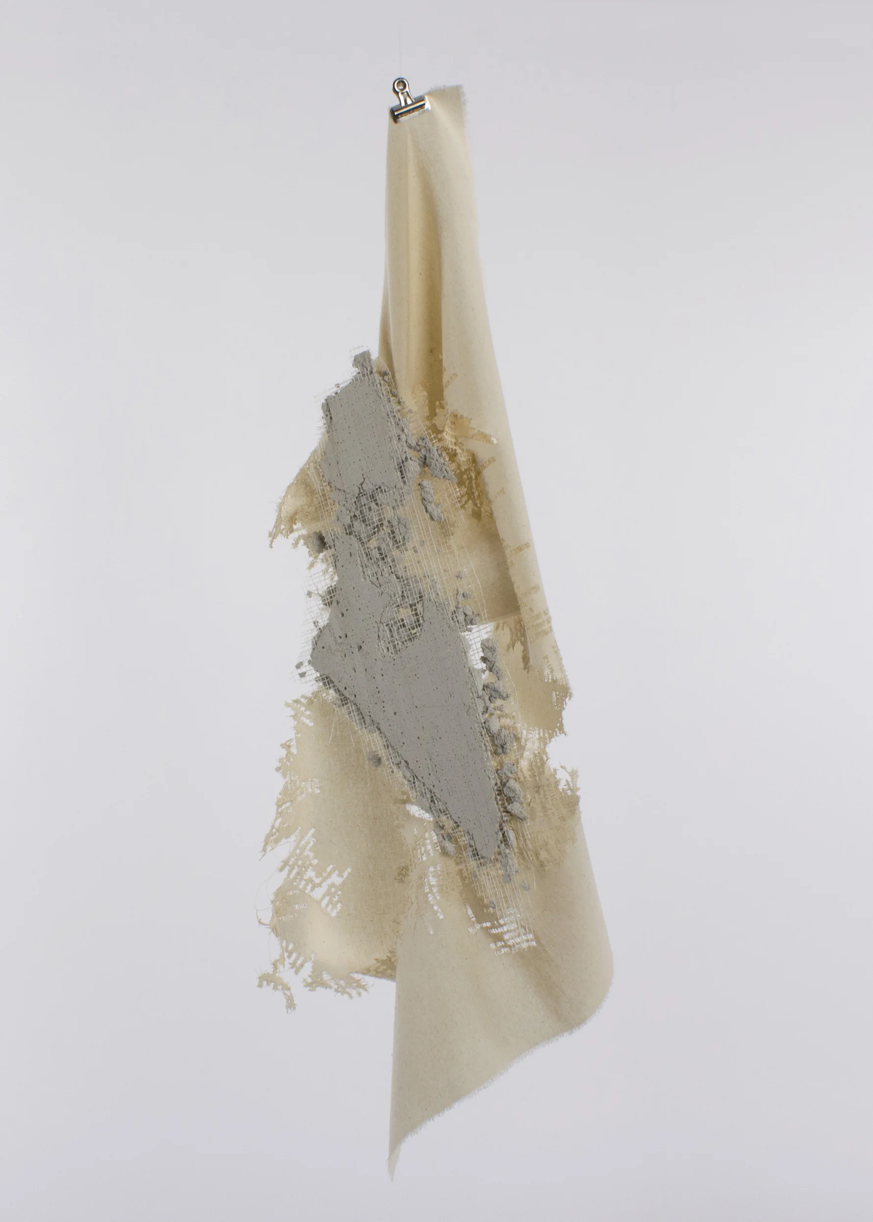
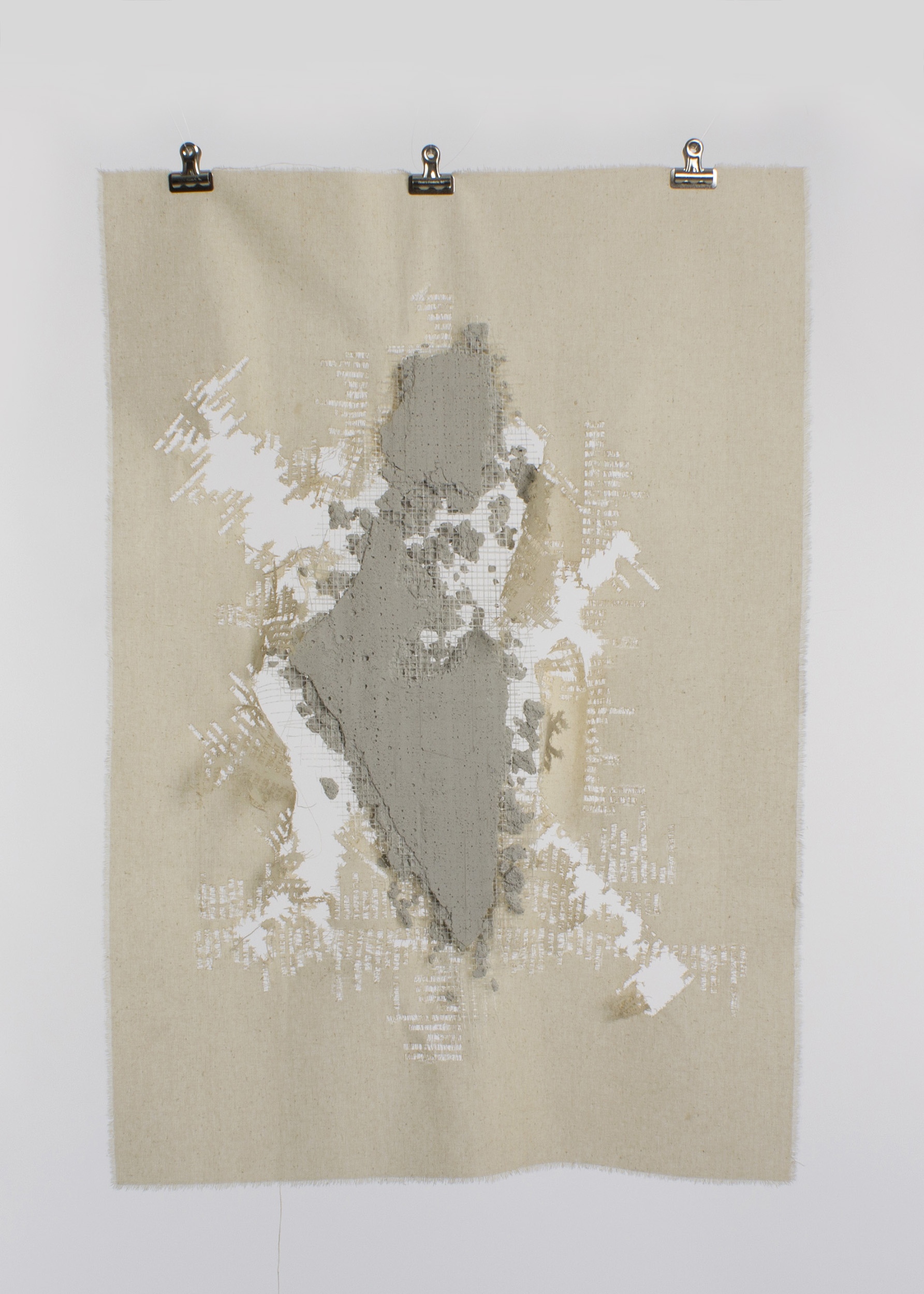
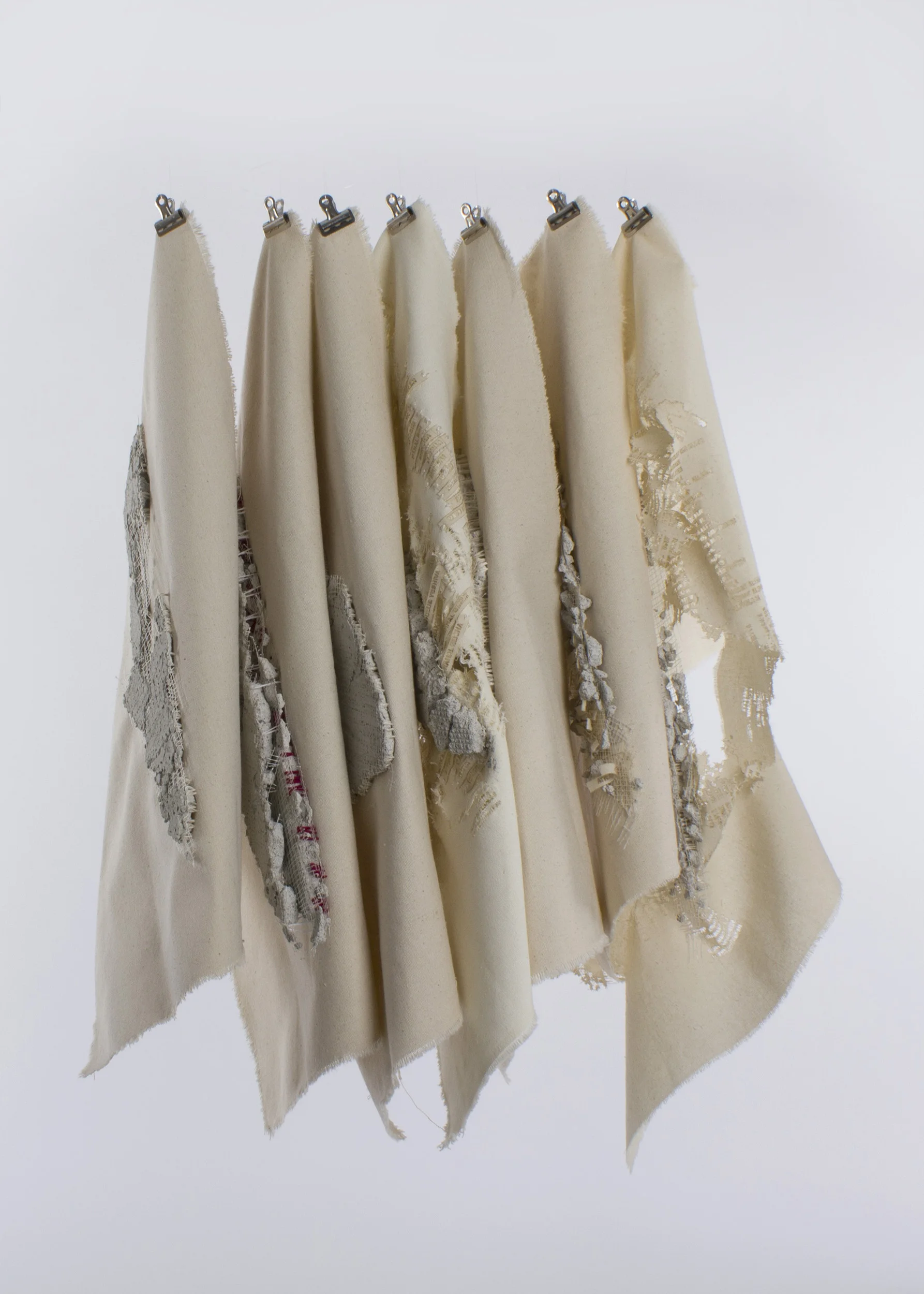
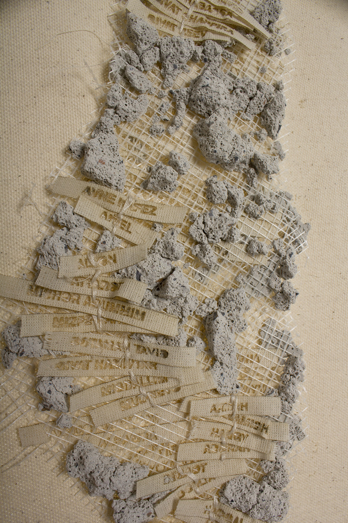
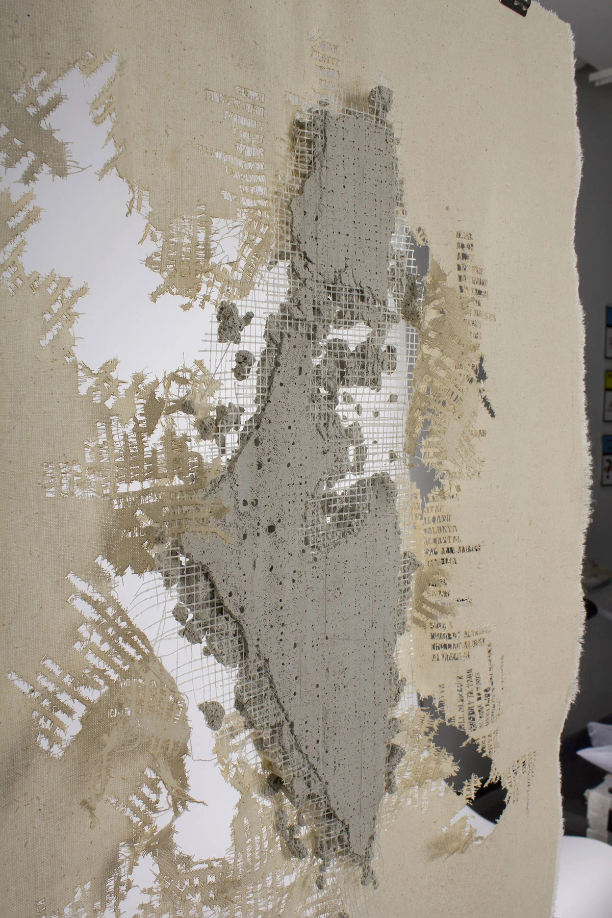
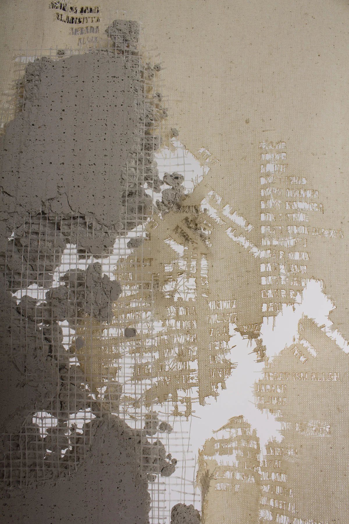
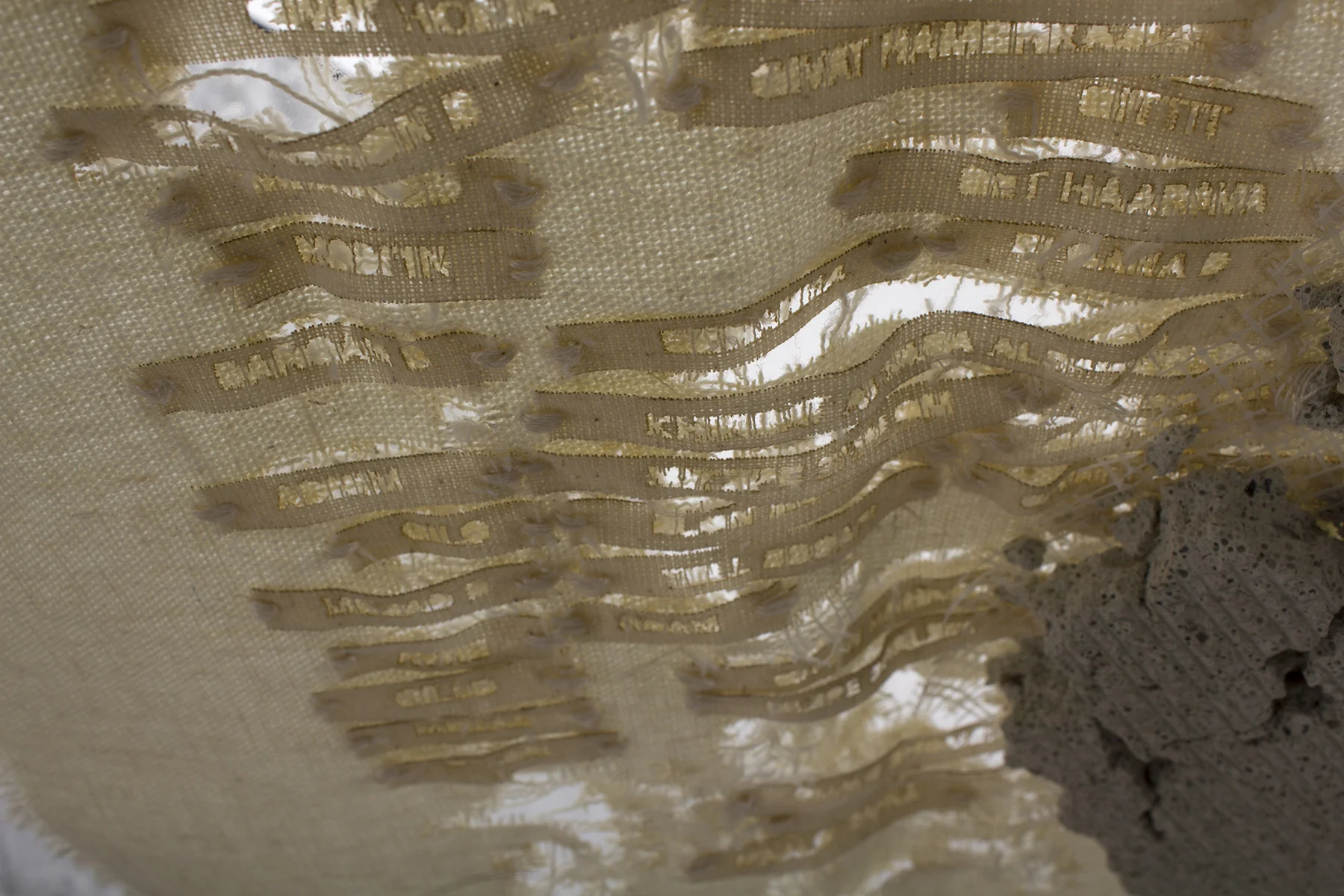
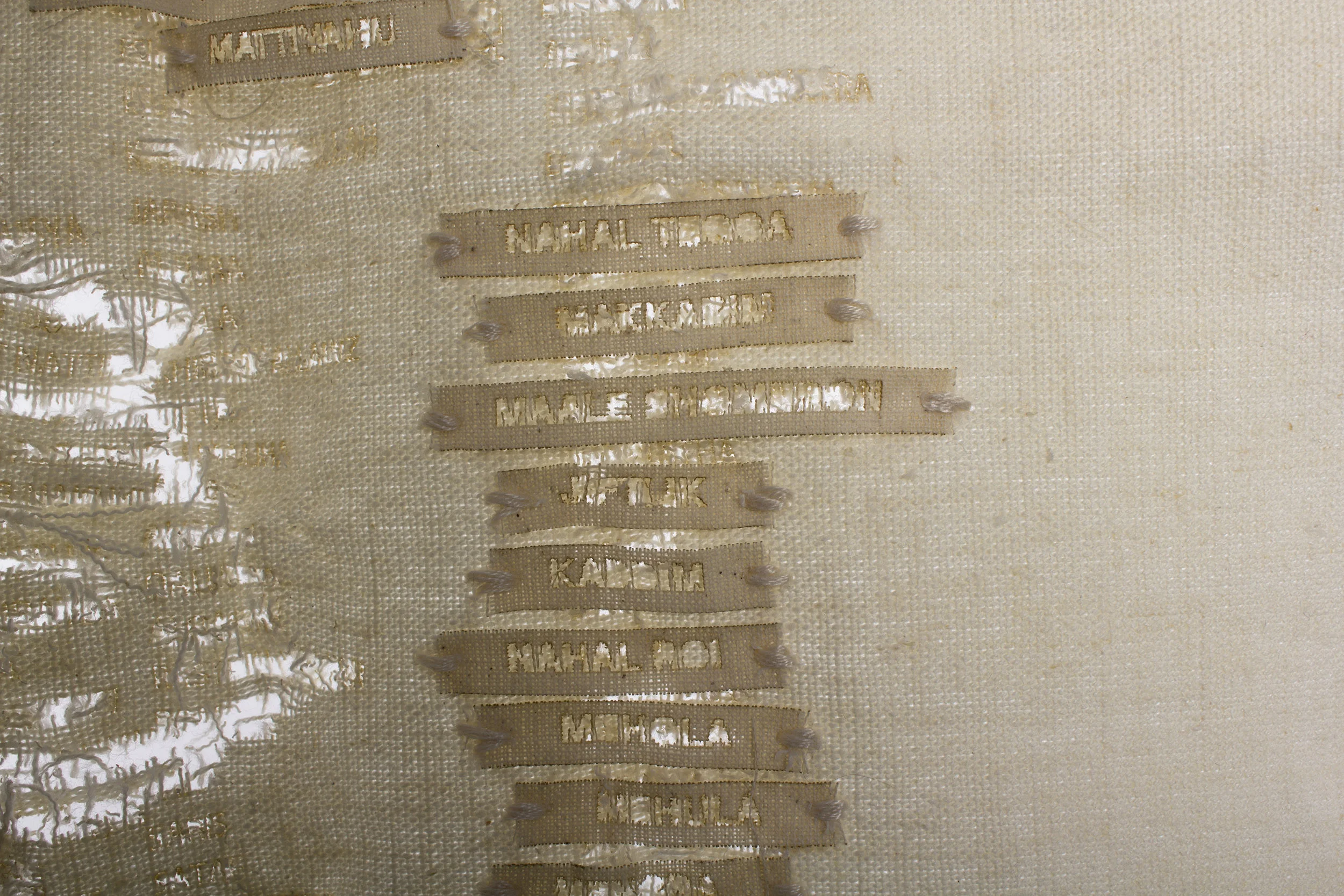
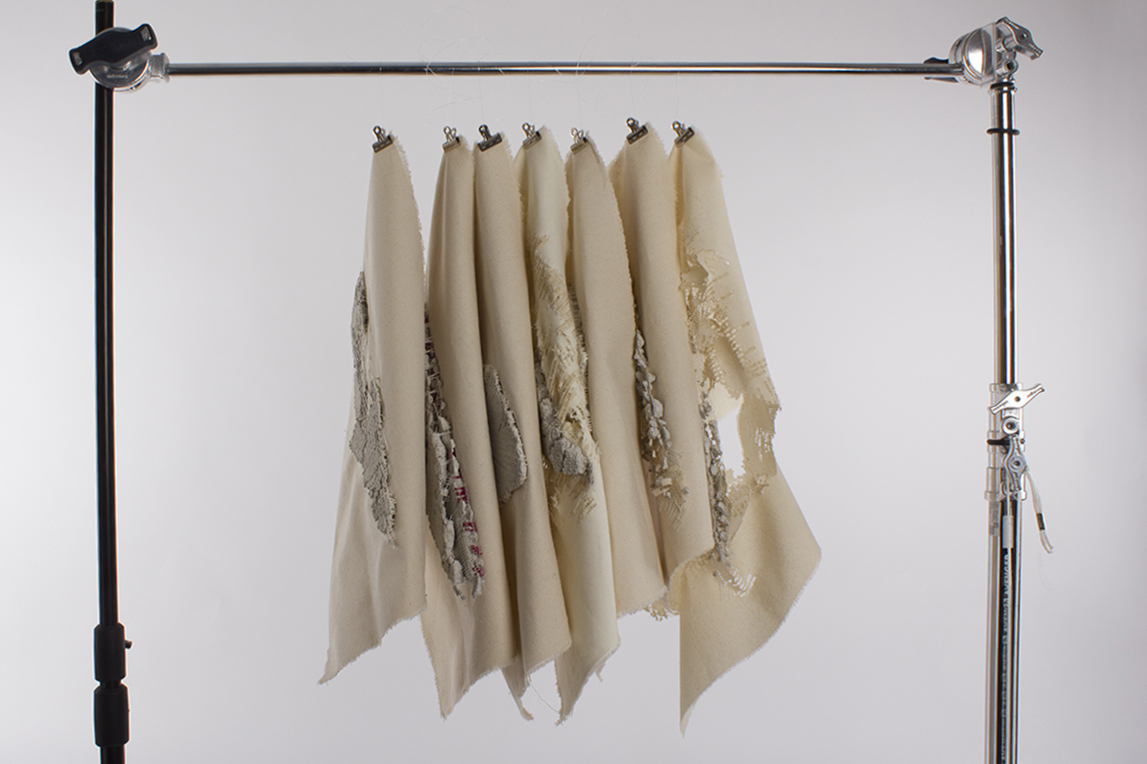
CONCRETE MAPS
Stitching on fabric, concrete, laser cut, 13.5" x 19"
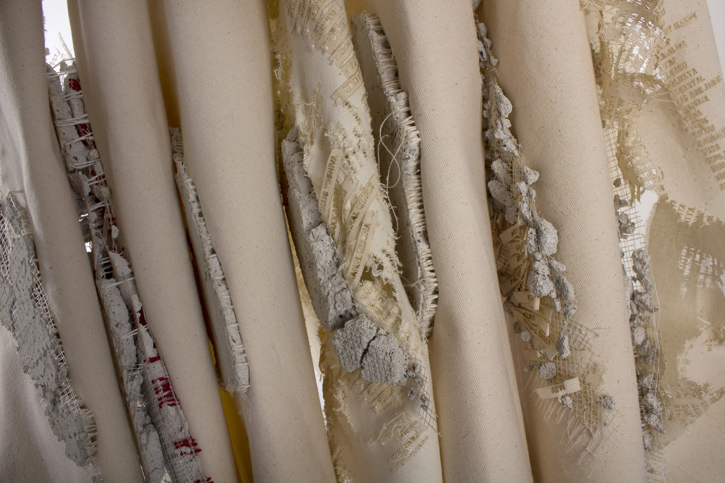
The Concrete Maps project is a commentary on the continuous act of occupation - building separation barriers, settlements, checkpoints, and walls. A process of building and dismantling, constructing and deconstructing, assembling and disfiguring, has delineated and shaped the state of Israel.
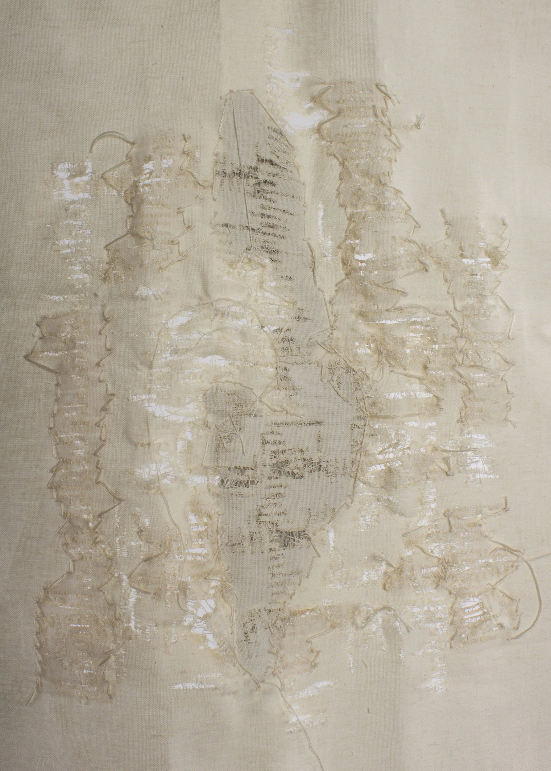
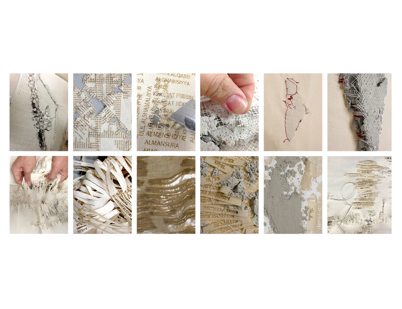
The Concrete Maps project also investigates the effacement of the Palestinian villages to allow for the manufacturing of an Israeli landscape. The maps illustrate the names of the demolished Palestinian villages since the 1920s. The grid-like layout echoes the initial Israeli master plans used to survey Palestinian villages. The Israeli settlements’ names are typographically superimposed over the villages’ names layer suggesting the “replacement process.” A cement map is then stitched on top of the canvas structure. The concrete map is used to illustrate the construction force present in the occupation.
“To what extent is destruction necessary for creation?” - Lebbeus Woods